PROGRESS REPORT
#6
December 2, 1999
Task Assessment
at the Luquillo, Puerto Rico, LTER
Myself as PI,
and Mike Willett the Project's Senior Technical Consultant,
visited Puerto Rico from November 21st to the 23d, 1999. The purpose
of the trip was several fold:
a. To determine exactly what will be required
to accomplish the first priority named by Dr. Jess Zimmerman,
the overall Luquillo Experimental Forest LTER PI for our NSF Wireless
Project in support of Field Research for Biological Sciences.
That priority is to link the three Weather Stations that operate
in three separate places within the
El
Yunque Rain Forest on the eastern
end of the island of Puerto Rico.
b. To determine the way the El Verde Research
Station will be linked to the Internet
from its currently isolated (only a cell phone) location
in the Forest.
c. To assess the general electromagnetic
environment within which the wireless
links will have to operate - density and location of RF
Transmitters. And operating experience by other operators of RF
equipment on the island.
d. To better understand the scope and variety
of scientific data-gathering experiments
that are being done as part of the Long Term Ecological
Research NSF Projects so we design
the first links in ways that will support later experiments.
e. To explore the next priority - after the
3 Weather Stations are connected
and operating reliably - for implementation in 2000.
THE
BASIC WIRELESS CHALLENGE
One of the special reasons why
the El Yunque Rain Forest is used for long-term
ecological research is that it is at once a U.S. National Forest,
under the control and protection
of the US Government. It is the only rain
forest with such status. Thus there is careful control over any
intrusion by man - whether roads
or facilities or permitted activities -inside
its' perimeter. Together with its natural characteristics - of
a forest which receives 5 meters
- over 200 inches of rain a year, and ranging
from near sea level to over 1000 meters in elevation - in an area
of the Caribbean subject to severe
weather extremes - it is an ideal laboratory
for study of the natural environment, and rare species of both
plant and animals.
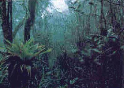
The denseness of the forest, with high canopy,
the humidity and destructive effect
of tropical atmosphere, makes it difficult to set out
experiments, keep them operating gathering useful data for years,
and gathering the data from them.
It is very labor intensive to conduct field studies
in the rough, wet, jungle that is El Yunque. The typical
experiment is set out where it is recurringly accessible by researchers.
In the case of the weather stations, which measure Min/Max Temperatures,
Relative Humidity, Precipitation, Wind Direction, and Speed, the
systems are placed in varying locations
in the forest, and at varying heights from
the forest floor to above the canopy. Data loggers are attached
to the sensors at each station, but
in every case, only accumulate data in a
memory bank, which is offloaded by a researcher or assistant,
generally every two weeks.
It is self-evident that if these data loggers
were in continuous communication
back to the El Verde Field Research Center - and through it to
the global internet - not only could the data be collected
continuously, and perturbations indicating trouble - storms damaging
the systems or their mountings permitting
immediate repair visits - but also certain
devices could be 'commanded' via the wireless link, to perform
certain tasks at times not anticipated when the static data loggers
were put out.
However the dense forest which can severely
attenuate radio signals, with far
less light reaching the forest floor than above the canopy - making
solar panel power more difficult,
as well as the weather extremes that can blow
over antennas or otherwise yank the radio equipment around, plus
the deterioration to sensitive electronic
equipment by the humidity, heat, and moisture,
all make it challenging to connect up the ultimate sensors no
matter where they are and must be,
reliably to the Research Center and the Internet,
where distant researchers can access them. (Of the 60 research
scientists working with the El Yunque Experimental Forest LTER,
only a small number are year around
in Puerto Rico).
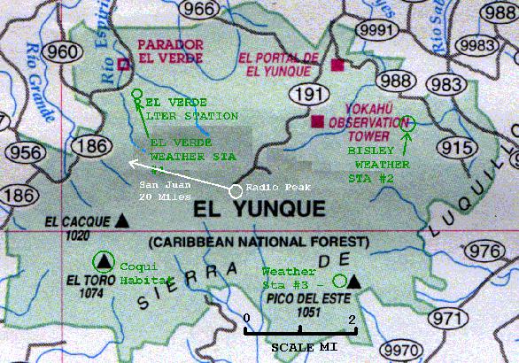
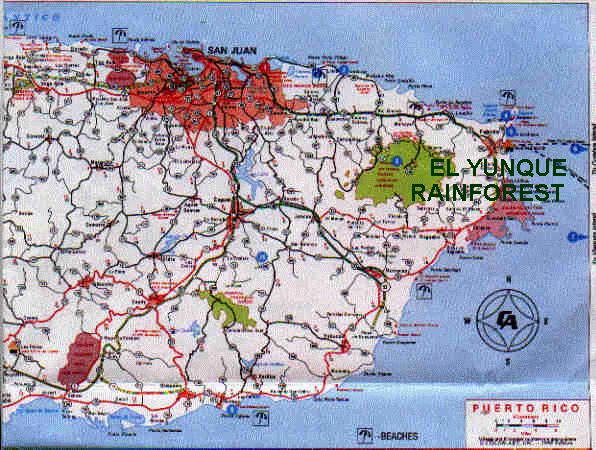
You may click on this next link to bring up
an enlarged view, fitting one browser
screen, of the El Yunque forest. In green is highlighted the three
Weather Stations which are the special research project of Dr.
Doug Schaefer, whose offices at the
Center for Tropical Studies are on the grounds of
the Medical Center part of the University of Puerto Rico, in San
Juan -20 miles from the forest. It
also shows the area around the top of El Toro
mountains where two subspecies (Eneidae, and Richmondi) of the
Coquigenus Eleutherodactylus - exist,
and are studied, and which the U.S.
Forest Service biologists study in loose collaboration with the
NSF LTER project and which they wish
we could connect wirelessly. Then in white, the
dominant peak 'Pico el Yunque' at 1050 feet is shown, where there
is a large concentration of communications
towers, and which will probably have
to be used by the LTER project to reach, wirelessly at affordable
recurring costs, San Juan. Which
is a separate University and LTER project from
this NSF project - but which project will have to depend on the
links back to San Juan from El Verde
Field Station, and the data collection points
in the forest.
And RF interference with the low
power radios we expect will be most useful
where economics is also an issue.
The high bandwidth link from El Verde
Research Station (and its associated 'Stream House' buildings
about 1.5 miles north along Road 186) is NOT part of this
NSF wireless project. It IS however part of the LTER NSF
Funded LTER Project under Jess Zimmerman. But it's a critical
requirement before any of the data from the field locations
will be able to be accessed via the Internet at large -
beyond El Verde. So the LTER is negotiating with Open Minds
Company, to provide that links - both data and voice - back
to the Ecological Institute's premises in San Juan. The
url below is a proposed schematic wireless, and voice over
IP solution by OMC.
Open Minds (OMC) Proposed Links:
http://www.omc.com/News.html
WEATHER STATION
#1 AT EL VERDE
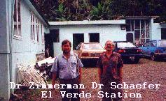
The El Verde Research Center is inside the
forest. It is the base of operations
for field experiments into the forest. It has minimum living accommodations
for researchers, and buildings where the desktop computers available
for work reside.
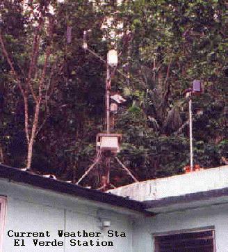
| The current location of one
of the weather stations managed by Dr. Doug Schaefer
is on the building which houses the computers. Its' data loggerleads
extend into the building. It
is not an ideal place for it to be, far below the
canopy. So it is being moved to the top of the 75 foot tower
which sits at 350 feet of elevation,
just south of the Research Station, and
about 300 feet away. |
 |
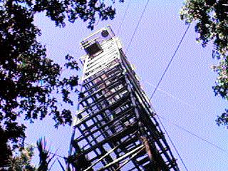
Thus this will be one of the tower-weather station
sites (we will call it arbitrarily
weather station #1) to be linked to the Internet. But it is likely
that the most efficient way to do this will be to lay cable from
the Campbell CR10X data logger the
short distance to the computer center. But the
tower above the canopy will be used to mount the El Verde base radio
and antennas, for communications with
both the wireless link to the top of Pico
el Yunque, where its' corresponding radio will be interfaced to
whatever link is made to San Juan,
20 miles away, and the Ecological Studies
Center. Whether this radio on Tower #1 will, or can, directly communicate
with the radios on Towers 2 and 3 remains to be seen. Only the physical
test from on the top of the towers will determine that. A previous
helium 'balloon' test at Tower #1 at El Verde by Mike Willett
shows that an antenna high enough above the 75 foot Tower #1 can
be seen directly from a radio tower
complex on the top of El Yunque.
WEATHER
STATION #2 at BISLEY
The second Weather Station is
in an area named after a stream, Bisley.
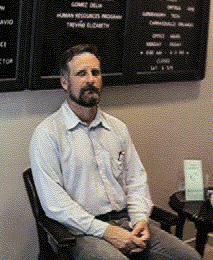
This one is sampled by the collaborative National Forest Service
researchers, under the supervision
of Dr. Fred Scatena shown here at the Catelina
NSF Field Office - one of the two places (the other being the
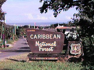
Sabana Work Center) on the eastern
half of El Yunque from which the National
Forest Service works and administers the 'Caribbean National Forest'
- El Yunque.
It is a jeep ride over roads closed to the
public to get to the Bisley area,
where, after a 1/2 mile climb through the forest to a ridge at
the same 350 foot altitude level
as Weather Station #1 at El Verde, one
reaches Tower and Weather Station #2 - the Bisley Weather Station.
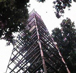
This tower is over 110 feet high, clearing
the canopy, and with a good view
blocked only by the terrain forms, in every direction, including
the top of El Yunque, and the location
of Weather Station #3 on Pico del Este,
700 feet higher in elevation. This station also tracks Min/Max
Temperatures, Relative Humidity,
Precipitation, Wind Direction and Speed. But
it also, reflecting an interest by researcher Fred, contains devices
for measurements with a quantum light
sensor, which measures a wide range of
light spectrum, including IR, as well as a PARE light sensor,
which is primarily sensitive to the
light spectrum most effective in the
photosynthesis process of plants.
At the bottom of the tower is a second Weather
Station, used for spare parts for
the first, but also collects data at the forest floor to be compared
with the collectors at the top of the Tower above the trees.
Close by is a third data collector station,
which is on a stream, where stream
data - a specialty of Dr Scatena - resides. This is discussed
in Progress Report 7.
We will be working with the technician stationed
at Sabena under Fred Scatena's supervision
when we install the wireless at Bisley and Pico del Este,
so he learns how to handle the wireless, and further develop or
troubleshoot it.
The Bisley sites, however, will pose a substantial
challenge to supply sufficient recharge
power to the battery systems serving both the weather stations.
Solar power may not be enough.
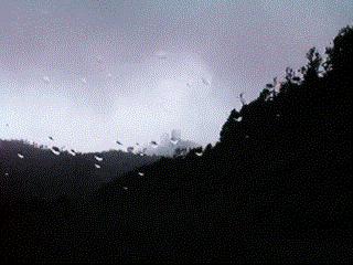
WEATHER
STATION #3 - at PICO DEL ESTE
The third weather station we have
been asked to link up, is high on a
ridge near the Naval Radar Facilities on Pico Del Este, reachable
by a closed to public very rough
(in stretches) road, generally requiring a 4 wheel
drive vehicle. This high area gets large quantities of rain, and
is often 'in the clouds.'
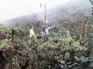
This weather station is low to the ground,
only rising perhaps 10 feet from
its base, but on a saddle of the ridge open to the north. It has
all the elements of the other stations,
with one interesting exception. It has a
'Cloud Drip' collector that is designed to capture and measure
the water which collects and condenses
on vegetation as the wind pushes the ever
present low fog-like clouds over the 1000 foot ridge. At one time
when a researcher reported more water
coming down the mountain than could be accounted
for by rainfall, it was concluded that the balance 'may come from
cloud drip.' This station tests that
thesis. The prevailing winds may
make our use of wind generated recharge power feasible, and more
useful than solar panels.
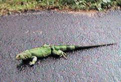
On the way down from Pico del Este, we spotted
some of the wildlife that inhabit the
forest. A large Iguana, which Dr. Scatena states is rarely seen
this 'high' because of the colder climate on the higher ridges and
hills.
SUMMARY
Our site survey of the three Weather Station
sites clearly show the problems we
face. Since all three stations use similar Campbell Scientific
sensors and data loggers (they will
be concentrating on using the CR10Xseries),
we should have little problem interfacing them to the data
radios. But getting the date radios to link to each other and
the El Verde Research Center reliably,
and maintain rechargeable power at each site, will
pose the biggest challenge.
In Progress Report #7 I will detail other work
we will do in the future, after the
three Weather Stations are satisfactorily linked to El Verde, the
Tropical Studies Center in San Juan, and the Internet at large.
Dave Hughes
Principal Investigator
Note - there are two textual reports
accompanying this Progress Report.
1. Report
by Engineer Mike Willett who accompanied me and drew his own conclusions.
It is a 'sub' report like the Progress Reports, but only accessible
from here.
2. An informal narrative
report on this trip by me.

